Big data and its purported utility comes with the attendant need to actually collect that data in the first place, meaning an increase of sensing devices being attached to all manner of things. That includes treating many everyday things, from skyscrapers to human beings, as sensors themselves.
When it comes to the urban environment, data on air quality, weather, traffic, and other metrics, is becoming more important than ever. However, in general, the sensors that collect this data are fixed, attached to buildings or found in other stable spots. “They’re good in time, but not in space,” said Kevin O’Keeffe, a postdoc in MIT’s Senseable City Lab, in a release from the university. Airborne sensors such as drones, on the other hand, explained O’Keefe, work well in space, but not in time. To collect greater data that more accurately reflects an entire city—in both space and time—mobile sensors would be needed at street level.
Cities already have fleets of mobile devices close to the ground: vehicles. While private cars operate only sporadically, and buses run fixed routes, taxis spend all day and night traversing large swaths of cities. Incidentally, the lab also tried using garbage trucks, but they did not collect as much data as they predicted cabs could.
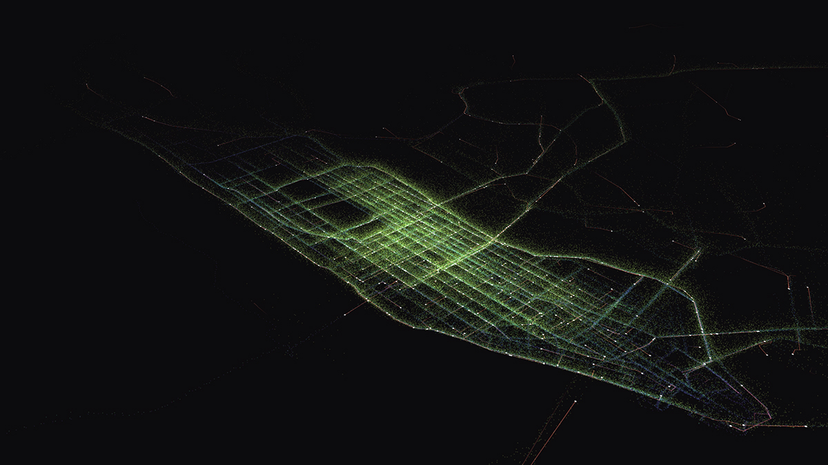
Inexpensive sensors could be attached to taxis to provide researchers and others important data on the on-the-ground status of urban environments. However, to see the viability of this concept, the Senseable City Lab had to first find out just exactly how much ground taxis actually cover. And then, how many sensor-enabled taxis would it take to create an accurate picture of a city’s terrain and air quality?
By analyzing taxi routes in New York City, researchers discovered that a relatively small number of cars covered a pretty wide territory. It took just ten cabs to cover a third of Manhattan in a single day. And, while one might expect this to be particular to Manhattan and its orderly grid, the researchers also discovered that similar patterns occurred in cities across the world, from Vienna to Singapore. That said, because many taxis travel to similar areas and along high-traffic routes, the number of cabs it takes to cover even greater ground grows quite rapidly. In the case of Manhattan, it takes 30 taxis to cover half the island and over 1,000 to reach 85 percent.
To realize the full potential of car-borne sensors, which can reach popular areas as well as underserved ones, O’Keeffe suggested a hybrid approach: placing sensors on taxis along with a few dedicated vehicles, à la Google Street View.
The research team hopes that this data will help planners and politicians put together a more realistic idea about how mobile sensing could work in their city, its cost, and potential impacts. The data will also hopefully help cities tailor any mobile sensing projects to their particular needs, and the Senseable City Lab believes that these mobile sensors would be less expensive than traditional options.
This research also appears in a paper recently published in the Proceedings of the National Academy of Sciences that was co-authored, along with O’Keeffe, by Amin Anjomshoaa, a researcher at the Senseable City Lab; Steven Strogatz, a professor of mathematics at Cornell University; Paolo Santi, a research scientist at the Senseable City Lab and the Institute of Informatics and Telematics of CNR in Pisa, Italy; and Carlo Ratti, director of the Senseable City Lab and professor of the practice in MIT’s Department of Urban Studies and Planning. Curious urbanites can check out the accompanying maps and infographics on the lab’s website.